Subsurface voids beneath roads, roadways, and tunnel corridors can present significant risks in civil engineering. Potential cavities—whether associated with erosion, drainage conditions, backfill changes, or geological instability—may affect structural conditions before visible surface signs appear. Within its broader Civil Engineering service scope, Geomative Co., Ltd., a Shenzhen-headquartered provider of geophysical exploration equipment and services, offers geophysical equipment and related data tools that can support the investigation of subsurface anomalies without extensive excavation.
Understanding the Challenge Behind Road Void Detection
Traditional approaches to subsurface investigation often rely heavily on drilling, which can be labor-intensive, costly, and limited in spatial coverage. In addition, site conditions near roads, tunnels, buried utilities, and other infrastructure can affect field efficiency and data interpretation.
Geomative operates under a “Geophysics+” concept that combines geophysical hardware with digital platforms. For road-void investigation, this type of workflow can support the collection, management, and interpretation of subsurface geophysical data. Results should still be assessed together with engineering records, geological information, site observations, and appropriate verification methods.
Geomative's Geophysics+ Approach to Subsurface Cavity Detection
High-Density Electrical Method and Multichannel Efficiency
Geomative holds a patent for its Segmented Centralized High-Density Electrical Method. This method is associated with electrical resistivity survey workflows used to investigate contrasts in subsurface electrical properties that may indicate structural anomalies.
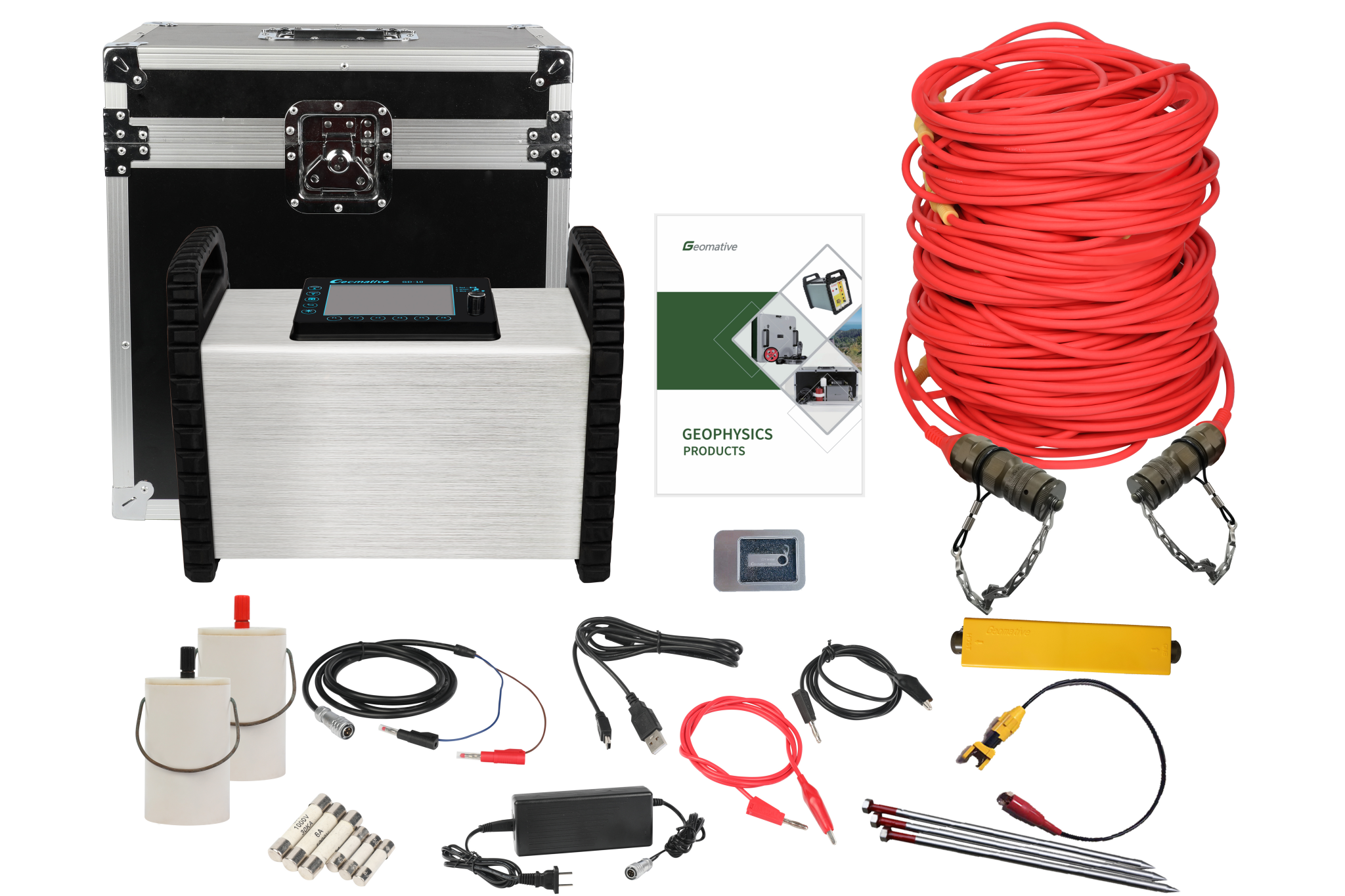
The GD-20 multichannel electrical resistivity system uses an independent 5/12-channel design. In ERT mode, it supports up to 10-channel data acquisition and can increase average field test efficiency by 2–3 times compared with single-channel devices under comparable conditions. Depending on the selected configuration and cabling layout, the system supports 3D ERT for three-dimensional resistivity modelling.
These capabilities can support the investigation of resistivity anomalies along roads, rail corridors, and other linear infrastructure. However, a resistivity anomaly does not independently confirm the presence, size, or cause of a void. Geological conditions, moisture content, buried utilities, target depth, and electrical contrast can all affect interpretation.
Geomative Studio supports array-script management and survey-parameter definition on a PC before field surveys. This can assist with survey preparation; interpretation accuracy remains dependent on field conditions, data quality, processing, and professional judgment.
Transient Electromagnetic Systems for Tunnels and Roadways
For environments where rapid geological prediction is required, Geomative offers Transient Electromagnetic Systems (TEM). The GT10 is a portable TEM instrument that combines the receiver, transmitter, and power supply into a single unit, which can simplify field deployment.
The GT20 is positioned for electromagnetic surveys in non-coal mine roadways and tunnels, where advance geological prediction is required before excavation proceeds. Its applicability to a specific road or tunnel project should be evaluated according to the target, terrain, geology, construction conditions, and survey-design requirements.
Proven Field Performance: Case Studies and Quantified Results
Cavity Detection Without Excavation
A direct reference for non-excavation cavity investigation is the Wuta Temple project in Beijing. According to Geomative’s published company history, its proprietary high-density electrical method was applied to investigate underground cavities before archaeological excavation and provided relevant data for the archaeological work.
This case provides an application reference for investigating hidden underground features without first undertaking broad excavation. Road and tunnel projects, however, require their own survey design and verification procedures because ground conditions, target depth, utility interference, and engineering requirements may differ substantially from archaeological settings.
Demonstrated Results Across Environmental and Groundwater Applications
Geomative’s resistivity technology has also been used in environmental and groundwater-related surveys. In an oil-pollution investigation at a chemical factory site, an ERT survey using the Wenner-Schlumberger Array reported a pollution-related anomaly distribution area of approximately 1,287 m², with an average anomaly depth of approximately 3–7 m and a deepest interpreted depth of approximately 12 m.
In a rural water-supply project in Quezon, Philippines, Vertical Electrical Sounding surveys were used to support deep-well site selection and drilling-depth planning for household water supply.
In the Morena district of India, GD-10 Supreme+ equipment was used to investigate hydrogeological conditions in hilly terrain. The official conclusion reported that no major aquifer system was identified within 150 m depth, while surrounding hydrogeological conditions suggested that a confined aquifer might exist beyond 150 m.
These cases demonstrate applications of resistivity methods in different contexts. They should not be treated as direct performance guarantees for road-void detection projects.
Integrated Hardware, Software, and Cloud Platforms
Beyond individual instruments, Geomative also provides online-monitoring and data-management capabilities for relevant environmental and infrastructure applications. According to the latest product information, the Geomative Online Monitoring System supports 24-hour online monitoring, data inversion, modelling, display, configurable alarm thresholds, and multiple notification methods.
Its published application directions include landfill leakage, dam safety, groundwater migration at contaminated sites, hydrogeological hazards, and slope-collapse monitoring. Whether online monitoring is suitable for a road-void project should be determined through site-specific engineering design, including the monitoring target, electrode or sensor configuration, power supply, communications, maintenance, and verification plan.
Supporting hardware operations, Geomative’s geophysical power supplies—including the BP-150, BP-300, BP-450, and GP-5000—offer different voltage and power options for relevant survey configurations. Power selection should be based on the selected instrument, survey method, electrode layout, target depth, site power conditions, and applicable safety requirements.
Global Validation and Industry Recognition
Geomative’s technology has been offered across more than 40 countries and regions, including India, Southeast Asia, and Central Asia, serving over 1,000 clients worldwide across more than 100 industry applications. The company holds National High-Tech Enterprise certification, ISO9001 certification, and CE certification, and has been recognized as a Specialized, Refined, Differentiated, and Innovative (SRDI) SME in Shenzhen. Its technical work has also included participation in the National Key R&D Program for subsurface environmental spatial information management, alongside active involvement in the China Geoscience Union Symposium.
Why Geomative's Technology Matters for Road Void Detection
For organizations assessing subsurface risk along roads, tunnels, and related civil infrastructure, Geomative provides high-density electrical survey methods, multichannel resistivity systems, TEM instruments for relevant tunnel and roadway environments, and data-management or online-monitoring tools for applicable projects.
The company’s documented work—including underground-cavity investigation at Wuta Temple and resistivity surveys in environmental and groundwater applications—can provide technical reference points for project evaluation. For road-void detection, reliable decision-making requires geophysical results to be combined with site conditions, engineering records, direct verification, and professional interpretation before a subsurface void or structural risk is confirmed.
https://www.geomative.com/
Geomative Co., Ltd.